Monday, December 29, 2014

The Causes of Reduced Well Flow


If your household water is supplied by a well, responsibility for maintaining your water supply falls to you, and there are many potential causes of what seems to be a loss of water pressure or water volume. In a well, a diminished water supply or well yield can be caused by drop in water level due to drought or over pumping of the aquifer, the well could be failing or fouling or there might be an underlying well construction or design problem. There are also equipment problems that seem to mimic a failing well- a leak in the pitless adaptor or pipe to the house or a worn or damaged pump impeller could reduce well flow or water pressure. Remember that equipment problems are the most common cause of well problems. So let’s start there.

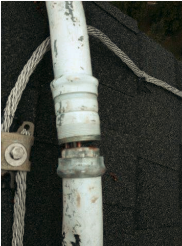
The essential components of a modern drilled well system are: a submersible pump, a check valve (with an additional valve every 100 feet), a pitless adaptor to bring the water to the house below the frost line, a sanitary sealed well cap to keep out vermin and bugs, electrical wiring including a control box, pressure switch, a pressure tank to literally push the water throughout the house and an interior water delivery system known as your plumbing. There are additional fittings and cut-off switches for system protection, but the above are the basics. To keep the home supplied with water each mechanical component in the system and well must remain operational.

A leak in the piping from the well to the house could reduce the well flow, a damaged pump or the components in the basement that provide consistent water pressure and the electrical switch that turns on the pump. Look for indication of moisture, and subsidence to find a leaking pipe between the well and the house. In the house water goes into the pressure tank. Inside the pressure tank is an air bladder that becomes compressed as water is pumped into the tank. The pressure in the tank moves the water through the house pipes so that the pump does not have to run every time you open a faucet. The pressure tank typically maintains the water pressure between 40-60 psi or 30-50 psi for smaller tanks. After the pressure drops below the cut in pressure (typically 40 psi), the electrical switch turns on the pump and the pressure in the tank increases as the tank fills. If however, the pump is not delivering water fast enough the pressure tank could fail to regain its head while the water is in use. Also, jiggle the tank to make sure that there is not a hole in the bladder and the area above the bladder is not filling with water and becoming water logged. Sometime just draining the pressure tank, bleeding the air out and recharging it will improve a situation, but like any mechanical piece of equipment pressure tanks do wear out.
from USGS


The well itself can also be the cause of reduced well flow. The well has a casing (a metal or plastic liner) that may extend the length of the well, or at least to the bedrock and then have some sort of slotted casing, screen or “sock” around the pump impeller to keep debris, sand and sediment out of the system. In Virginia, there have been well regulations in place since 1992 to prevent poorly designed and developed wells but, it still happens and there are still a huge number of wells that predate regulations.

If you are having a well drilled check to make sure that the well driller is licensed and that the well is built according to regulations (if your location does not have well construction regulations check the regulations in other states or provinces to make sure you get a quality well). Always use a local well driller with experience in your immediate vicinity, the type of well construction must be matched with the geology and the characteristics of the aquifer. Experience is often helpful (but not everyone is capable of understanding and learning from experience). An understanding of geology and hydrology, very local and detailed regulation, or enough experience of knowing what has worked before is essential when choosing between a perforated well casing or well screen, identifying the right size slotting or screening to use, the placement within the borehole of the screening or perforated liner, whether a sand pack is necessary and where to locate the pump in the well. Poor choices in any of these items could cause problems with excess sediment in your water or reduced well yield.

When you drill a well, mud and bore hole cuttings can partially plug the well. This material must be removed to allow water to freely enter the well during well development. A good well driller will do a better job of this, a less than good well driller will tell you that excess sediment in your new well needs a sediment filter and will happily sell you a new pump when the first one fails prematurely. Sediment does tend to reduce in the first year because not all of the cuttings are removed during well development. If the well has not been fully and properly developed, the well will often produce excess amounts of sediment or have a low water production yield. Though not every well drilled has the potential to provide enough water for a household (even in my water rich part of Virginia), poor choices in well completion design can render even a good well a poor producing well.

Groundwater supply can change because groundwater systems are dynamic. In the Valley and Ridge of Virginia (west of 95 and before the Appalachian Plateau) the geology is characterized by unconsolidated overlay underlain by fractured rock. In the Piedmont region the fractured rock tends to be sedimentary rock and is carbonate rocks within the areas of karst terrain. Fractured rock systems tend to be water rich areas of Virginia, but not uniformly so. In the fractured rock systems of the Valley and Ridge wells draw groundwater from fractures in the bedding plane which run parallel to the vertical fractures. Fractures can run dry or become encrusted. In unconsolidated sediments of the coastal plain ground water is pulled from the saturated zone, but the wells needs to be screened. In the Appalachian Plateau which is a flat layered rock system with horizontal fractures, the coal seams are typically the aquifer and groundwater is typically shallow. Coal country is the location of many shallower dug wells which easily go dry during times of drought.

While many well problems are caused by poor construction, development or operation of the well, the geology can also be a source of problems. Reduced well yield can be caused by lack of recharge. The water withdrawn from an aquifer can be increased by building homes and increased use for irrigation, domestic watering of gardens and/or reduced recharge. The more land area that becomes covered with pavement, and buildings the less water percolates into the ground and recharges the aquifer. If water is withdrawn from a well faster than the aquifer is able to produce, the well is over-pumped and that is reported to be the most common cause of premature well failure. Over-pumping not only depletes the groundwater, but it rapidly increases the rate of sediment drawn into the well by the pumps suction, causing plugging of the perforated area where water flows into the well. It can also cause corrosion, incrustation and biofouling or the aquifer to compact which further restricts water flow to the well.

Sometimes a decline in water level is seasonal or due to a drought. Typically water levels are higher in spring and lower in the fall. Extended dry periods can also impact water levels, especially in shallow aquifers supplying dug wells. Checking the water level in your well or a nearby proxy monitoring well is a way to identify water level trends and aquifer depletion before the problem becomes serious. If you have the opportunity to install a level monitor for your own well, it is a way to identify a failing well or diagnose a problem, but in most instances it is not practical. For years I have coveted a water level monitor (also a Viking stove- but I don’t have either).

Mineral incrustation is a common problem in some aquifers where there is an abundance of dissolved minerals including calcium, magnesium and iron, as well as iron bacteria. If you have hard water, you well can become encrusted when minerals precipitate or settle out during the pressure changes in the pumping process. This causes scale deposits on the casing, liner and screens. Over time incrustation can reduce the flow of a well. If you have scale formation within the well a well can be treated with chemicals or acid or in some geology gently hydraulically fractured. To do this “right” takes equipment and knowledge. There are well treatment specialists and lots of people who have no clue. Be award that an old metal casing may not survive chemical or mechanical treatment and the well may collapse.

Installing and pumping a well often introduces bacteria into the subsurface and increases the level of oxygen and nutrients in the well and surrounding aquifer. Naturally occurring bacteria, such as iron bacteria or sulfur reducing bacteria, may thrive under these conditions. Iron bacteria, sulfur reducing bacteria and related bacteria can form a gel-like slime that captures chemicals, minerals and other particles such as sand, clays and silts. "Biofouling" occurs when the accumulations of gunk are sufficient to reduce water flow through screens and slats or impair the pump. This can mean reduced well yield and water quality. Iron bacteria buildup is a problem that I have dealt with. A couple of years ago I chlorinated the heck out of the well (800 ppm chlorine- I kid you not). That single treatment has kept my house and hopefully my well iron bacteria free since. I keep an eye out for slime build-up on the toilet flappers and will treat the system again when necessary- before I have reduced well yield or pump damage.

It is important to understand what is going on with your well before you begin replacing pumps or drilling new wells. Sometimes it’s just a loose wire or a waterlogged pressure tank, other times you have much bigger problems.

Thursday, December 25, 2014

Maintaining My Solar Panels


On the back of my house facing almost dead south is a roof mounted 7.36 KW solar array originally consisting of 32 Sharp 230 watt solar photovoltaic panels and 32 Enphase micro-inverters. When I made my purchasing decision in 2009 Sharp had manufactured 25% of the solar PV panels installed at the time and had been in the business for over 40 years. But since 2009 has suffered crushing competition by less expensive manufacturers and exited the business. The Sharp panel sold in the United States was manufactured in their Memphis Tennessee plant, which met the intent for the “Buy American” provision in the stimulus bill which provided the funding for a renewable energy grant I obtained from Virginia.

When I purchased my solar panels I also choose the Enphase micro inverter system. Though this system was more expensive than a single power inverter, it does two things for which I was willing to pay. The first is that the power cables running down the side of my house, albeit inside a pipe, are 120 current instead of 240. The second advantage to the micro inverters is that the energy production of each individual panel can be checked on the internet. My installation web page allows me to see the current energy produced by each of my 32 panels every minute, every hour, daily, weekly, monthly and the cumulative total power output. After two months of checking several times a day, I only spot check the solar panel midday a couple times a month. The reason I chose Enphase was to be able to easily identify a problem with the system. Little did I know that barely three years after the installation I would be facing repair issues.

Almost two years ago one of my solar panels appeared to fail. The original installer had gone out of the solar business, without renewable energy rebates and a viable solar renewable energy certificate market, there was not enough business to sustain a solar installation operation in Virginia. In addition, there had been difficulty with the installation- it had failed the electrical inspection three times before finally passing. However, his local roofing business appears to be successful. It took us a while to connect, but he referred me to a Maryland and Washington DC based installer, Lighthouse Solar. During the year and a half that I struggled to identify the problem with my solar system that seemed to get worse with each repair they tried to make, the two franchisees of Lighthouse Solar that I worked with went out of business or moved on. During the months while I was attempting to have my solar system serviced a second panel then a third panel appeared to fail.


Lighthouse solar struggled working with Enphase and Sharp and replaced one solar panel, two Enphase inverters and moved two panels. This did not fix the problem or even relocate it, nonetheless they remained convinced that the problem with the system was a faulty solar panel or panels. However, to me it was becoming increasingly clear that the problem was not originating in the panels or the inverters. The only other element to the system was the wiring. I was fortunate that when Lighthouse Solar exited the business he arranged with ProspectSolar to install a second solar panel that he believed would fix my ever growing problems (by this time my Enphase system only had 29 inverters reporting). When the field Superintendent for ProspectSolar came out, he flipped out at what he saw.

He found that the inch and a half conduit containing the wires for the system had come apart exposing the wires inside. He also noted that the conduit was oversized for the installation and that wire nuts were used to make the connections which are not an adequate transition method. I am told that the solar industry standard is to transition using insulated terminal blocks rated for the voltage.


ProspectSolar also noted that the box mounted on the east side of the house was mounted at an angle and the original installation crew cut a C conduit body at the same angle of the box and glued it together. This would void all UL listing rating and is not an acceptable application. The box wasn’t necessary since there is an existing prefabricated fitting that makes the turn. Other observations that ProspectSolar made were:


  • Most inverter companies call for rain tight fitting when pipe is exposed to the elements, my original contractor use standard fittings and wrapped them with duct seal.
  • The lay in ground lugs used to ground the system are only rated for one wire, to make  transitions the contractor should have used an irreversible crimp instead of putting multiple wires in the lug.
  • Racking companies make a flashing kit for the L-Feet, the L-Feet installed were screwed to the roof and caulked .However, my roof is not leaking and removing the solar panel racks is not advised at this time. 
  • A splice was made in the rail about a 8 inch section the piece was not long enough past the L-Foot so there is on a ¼ of the spice holding it together with 1 ½ self-tapper.
  • Instead of using the end clamps for the manufacturer to hold the panels down, the installer wedged the ground lugs in there to hold some of the top panels on and may be in danger of coming loose. 
ProspectSolar did not perform a full inspection but these observations were more than adequate for me to “get it.” The Solar panels were incorrectly wired and installed and it was probably faults in the wiring that were cause the panel and or inverter failure.

Prospect Solar would ultimately propose to perform the repairs on the system for $9.200. I contacted the original installer and sent him the notes and pictures that ProspectSolar had sent me. He surprised me and took full responsibility and found another subcontractor to correct his installation. Last week Jose arrived. Jose, and his crew had actually done the installation work on the solar system for the National Zoo Carousel. The system at the National Zoo is not much larger than my home system, but since he was working for PEPCO I hope he knows his stuff. Jose assessed the situation and explained to me that the electrical wiring is all wrong, many of the components are only rated for interior use and the system was not set up correctly.

At this point the plan is to remove all the solar panels, rewire the system and reinstall the solar panels. He estimates that once all the new parts arrive it will take about 5 clear and dry days. It’s December and almost Christmas. Jose has ordered his materials, the company I originally bought my solar system from is going to pay for the entire repair and reinstall of the solar PV system.

Wow, I was impressed by how honorably the original solar company has treated this problem. So, I am hoping for a mild couple of weeks at the end of January and that Jose is the guy who will finally fix all my problems. Since I am not paying him and he is merely a subcontractor, I do not control this process and cannot do a thorough vetting, but the truth is I could not even find someone to do a thorough inspection or even a repair without the assist from the original installer and Lighthouse solar. So, I will hope for the best, 

Monday, December 22, 2014

Fracking Banned in New York

In 2012, the New York State Department of Environmental Conservation (DEC) requested that the New York State Department of Health (DOH) review and assess DEC’s analysis of potential health impacts of hydraulic Fracturing (fracking). Last week the DOH has issued a 186 page report that finds fracking is a complex activity that could affect many communities in New York State because the Marcellus Shale covers a large portion of the state. The number of well pads could be vast and spread out over a significant portion of the state with different environmental conditions. This increase the risk of equipment failures and human error, and increases the risk for exposure to dust, methane gas, air pollution from the operation of equipment, water pollution and adverse health outcomes. Because of these concerns for potential impact to the environment and citizens of the state, New York has banned fracking.

The major findings of the New York DOH report are that there are potential environmental and human health impacts from fracking that include:
  • Increased truck traffic associated with fracking could have air quality impacts that could affect respiratory health due to increased levels of particulate matter, diesel exhaust, or volatile organic chemicals.
  • Fracking could contribute to increasing climate change by releasing methane to the atmosphere and making it cheaper to use natural gas to heat homes and make electricity delaying the adoption of renewable energy sources..
  • Faulty well construction could allow methane and/or fracking water containing a mix of chemical to contaminate potential drinking water supplies.
  • Surface spills potentially resulting in soil and water contamination.
  • Surface-water contamination resulting from inadequate wastewater treatment.
  • Earthquakes induced during fracturing. (Though federal studies have found that induced earthquakes are associated with deep well disposal of waste water not fracking itself.) 
  • Community impacts associated with boom-town economic effects such as increased vehicle traffic, road damage, noise, odor complaints, increased demand for housing and medical care, and stress.
This report from the DOH served more as the argument for the ban rather than a scientific study. A recent study by scientists reviewed all 166 fracking studies that have been performed and peer reviewed to consolidate all that we know about fracking and identify the areas where more research needs to be performed. This paper is  a complete and thorough review of all the risks and benefits and area where more study needs to be performed for the hydrocarbon extraction method known as fracking. The paper: “The Environmental Costs and Benefits of Fracking” in the Annual Review of Environment and Resources.( Annu. Rev. Environ. Resour. 2014. 39:7.1–7.36) by Robert B. Jackson formerly of Duke University and now at Stanford, Avner Vengosh, still at Duke University, J. William Carey, from Los Alamos National Laboratory, Richard J. Davies, from Durham University, Thomas H. Darrah, for Ohio State University, Francis O’Sullivan, from MIT and Gabrielle P´etron from the University of Colorado at Boulder.

Fracking is the current method of extracting unconventional oil and natural gas that is locked inside impermeable geological formations. Fracking is enabled by horizontal drilling and hydraulic fracturing (thus the name fracking). Fracking or hydraulic fracturing as it is more properly known involves the pressurized injection of fluids made up of mostly water and chemical additives into a geologic formation. The pressure used exceeds the rock strength and the fluid opens or enlarges fractures in the rock. As the formation is fractured, a “propping agent,” such as sand or ceramic beads, is pumped into the fractures to keep them from closing as the pumping pressure is released. The fracturing fluids (water and chemical additives) are partially recovered and returned to the surface or deep well injected for disposal. Natural gas or oil will flow from pores and fractures in the rock into the wells allowing for enhanced access to the methane or oil reserves.
From USGS the extent of the Marcellus Shale


Throughout their study the scientist recommend a series of research questions that should be answered to more fully model and understand fracking, but not banning . In addition they emphasize the need for greater transparency from companies and regulating agencies in information and the need for baseline studies prior to drilling is critical to even know if water or human health has been impacted. Predrilling data needs to include measurements of groundwater and surface-water quality and quantity as well as air quality, and human health. The scientists pointed out that there have been virtually no comprehensive studies on the impact of fracking on human health while state regulators and law in some instances allow fracking virtually in people’s backyards. The New York regulators have now banned fracking because it is not completely understood, the risks imperfectly managed and will likely contribute to climate change.

Thursday, December 18, 2014

What Caused the Mineral Virginia Earthquake?


from USGS

On August 23, 2011 just outside of Mineral, Virginia a 5.8 earthquake occurred about five miles beneath the earth. The earthquake was felt by people from Georgia to Canada. The earthquake caused wells in my neighborhood to spew mud and foundations to crack and we are more than 60 miles northeast. The question is why did the earthquake occur near Mineral, Virginia and why was the earthquake felt here?

Those of us who took rocks for jocks (survey of geology) in college know that the Earth's crust is comprised of a series of continental and oceanic plates that are constantly moving. The plates ram into each other, sliding underneath or above each other, or pull apart. Most earthquakes arise along such fault zones and is triggered by the plate movement. The ground first bends and then snaps forming an earthquake to release energy along faults. There are no plate boundaries in Virginia, so, why did we have an earthquake?

The U.S. Geological Survey (USGS) scientists have been investigation why seismic events occur in certain parts of the central and eastern United States, like the Central Virginia seismic zone, since there are no plate boundaries there, unlike the San Andreas Fault in California, or the Aleutian Trench in Alaska.

In 2012 USGS scientists conducted low-altitude geophysical (gravity and magnetic) flight surveys over the epicenter of the earthquake, located about eight miles from Mineral, Virginia. Deep imaging tools were used because the earthquake occurred about five miles beneath the earth’s surface. Maps of the earth’s magnetic field and gravitational pull can show subtle variations that reflect the physical properties of the deeply buried rocks. From this information deep earth maps of the region were drawn.

According to Anji Shah, the lead author of the study: “These surveys unveiled not only one fault, which is roughly aligned with a fault defined by the earthquake’s aftershocks, but a second fault or contact between different rock types that comes in at an angle to the first one. This ... suggests that the earthquake occurred near a ‘crossroads,’ or junction, between the fault that caused the earthquake and another fault or geologic contact.”

The magnetic data obtained by the USGS showed a wide bend in the deeply buried rocks within the Central Virginia seismic zone. This anomaly suggests to the USGS scientists that seismic activity may be increased in other nearby areas with locally increased rock weakness or permeability. The primary fault line of Mineral earthquake (and its aftershocks) runs to the northeast almost continually for tens of miles practically to Haymarket. According to Dr. Shah the continuity of the associated geologic structures probably allowed the seismic energy to be carried in that direction, consistent with moderate to high levels of damage from Louisa County to Washington, D.C., and neighboring communities.

The gravity and magnetic data found that a fault seems to separate different types of rocks with varying densities and strengths. The scientists believe that the junction between the faults may be the origin of the earthquake and wonder if similar junctures exist elsewhere. There is still so much to learn about Earth and this is just one small step towards a deeper understanding the earth around us.

Monday, December 15, 2014

Demographics Doom Climate Talks

The most recent United Nations Framework Convention on Climate Change meeting held in Lima, Peru to once more discuss, negotiate and talk about climate change finally ended early Sunday morning.  Despite  being extended over 30 hours to try to salvage some sort of agreement, nothing was really accomplished. The agreement announced and issued in the wee hours of Sunday morning was so watered down as to be practically meaningless. The agreement calls for:

Reaching an agreement next year in Paris that reflects "differentiated responsibilities and respective capabilities" of each nation. Developed countries will provide financial support to "vulnerable" developing nations. And countries will set targets that go beyond their "current undertaking" without any accountability.

The talks in Paris next year will fail to produce a plan that will make any difference despite the “historic” climate agreement between President Barack Obama of the United States and President Xi Jinping of China announced last month. If you will recall the United States promised to reduce greenhouse gas emissions (primarily carbon dioxide, CO2) 26-28% from 2005 levels by 2025. This was an increase from the previously promised reduction made by President Obama for the United States to reduce CO2 emissions 17% by 2020 and 83 % by 2050. To achieve this goal the United States will have to reduce their standard of living and quality of life even with increases in efficiency of electrical production and gas mileage it cannot be accomplished any other way given the current and foreseeable technology . This would require approximately doubling annual CO2 reductions from 1.2% from 2005-2020 to 2.3-2.8 % from 2020-2025.
China will not cap their greenhouse gas emissions or economic growth, but instead announced its intent to peak CO2 emissions around 2030 (right about the time their population is due to peak). China also plans to increase the share of non-fossil fuels in electrical generation to around 20% by 2030. China had previously pledged to increase the share of non-fossil fuels for energy to around 15%.

The climate talks in Paris next year will fail to produce a meaningful plan to reduce world CO2 emissions because it can’t be done. The developing world will not cap their greenhouse gas emissions or economic growth while they are still poor. The developed world no longer represents the lion’s share of CO2 emissions. In 1990’s when the Kyoto Treaty was signed by the European Union, Japan and Canada, the developed world represented 72% of global CO2 emissions from fuel, now they represent about 43% and falling. Europe’s birth rate has plummeted and Europe’s population (including Russia and Eastern Europe) of 740 million is projected to decrease to 726 million by 2050. The population of the United States is projected to grow from about 316 million today to 440 million by 2050.

Asia is home to 60% of global population. China and India account for more than half of Asia’s total population. China’s total fertility rate is a very low 1.5 children per woman. India is projected to pass China in population size in about 15 years, becoming the world’s most populous country and is projected to have 1.625 billion people by 2050 while China’s population is projected to begin to fall from 1.357 billion today to 1.314 billion in 2050. Combined, they will represent about 30% of the world’s population. At the climate talks in 2012 China’s chief climate negotiator Xie Zhenhua announced that China’s CO2 emission would peak around 2030, pointing out that its per capita gross domestic product would have only reached half the level of other developed countries’ CO2 emissions when they peaked. No comment was made on the projected peak per capita CO2 emissions we are left to guess..


The only way to improve the standard of living and quality of life of their citizens is through the use of energy, for industry, transportation, lighting, water treatment and delivery, sewage treatment, growing food everything depends on energy most of which comes from fossil fuels. Even with increasing efficiency more carbon will have to be burnt to raise the standard of living of the developing world.

The world carbon emissions are growing each year faster than the developed nations can cut them even if we had the will to reduce our living standards to accomplish that. In addition, the developed world is growing older and will not have the financial resources to meet the promises that were made in their national social contracts. We may be rationing healthcare along with electricity and be unable to provide financial support to "vulnerable" developing nations. The United States will face a trade off of reducing living standards even further or missing the President's goals. .

Thursday, December 11, 2014

Arsenic in Well Water a Heart Attack Risk

Worldwide, cardiovascular disease is the leading cause of death. In a growing number of studies that began in Asia where chronic arsenic poisoning is a huge problem it has been found that drinking water contaminated with arsenic increases the risk of cardiovascular disease. The higher the levels of arsenic the higher the death rate. (The risk was significantly increased for anyone who smoked or had ever smoked.) This has been confirmed in recent years in studies performed in Bangladesh, Taiwan, Chile and Mexico. Older studies have linked long-term exposure to arsenic in drinking water to cancer of the bladder, lungs, skin, kidney, nasal passages, liver, and prostate. Non-cancer effects of ingesting arsenic include cardiovascular, pulmonary, immunological, neurological, and endocrine (e.g., diabetes) effects.

Arsenic exposure is not just a risk in Asia and South America. As recently reported in the New York Times a meta-analysis of data from the quarter century of data from the Strong Heart Study of 13 American Indian tribes and communities in three geographic areas: an area near Phoenix, Arizona, the southwestern area of Oklahoma, and western and central North and South Dakota found an association between chronic arsenic exposure and heart disease. The scientists compared urinary arsenic levels in the population and found that as levels of arsenic rose so did the incidence of atherosclerosis, stroke and heart attacks. For those with chronic long term exposure to arsenic the risk of cardiovascular disease could be as high as two times dependent on concentration of arsenic exposure. In general, though, the dose response is about 25% increase in death from cardiovascular disease from each increase in arsenic concentrations by about 115 parts per billion. The U.S. Environmental Protection Agency (EPA) drinking water standard for arsenic in public water supplies is 10 parts per billion.

The Bangladesh study (by Dr. Yu Chen et al) they quantified the relationship between even low levels of arsenic exposure and increased risk of death for smokers. Study participants who were current smokers, had smoked for at least 20 years, or had smoked for at least 10 pack years at the beginning of the study were found to be 2.2-2.7 times more likely to die from heart disease.

Arsenic is a ubiquitous metal in the earth’s crust. Arsenic occurs naturally in rocks and soil, water, air, and plants and animals. It can be further released into the environment through natural activities such as volcanic action, erosion of rocks, and forest fires, or through the use of arsenic by mankind. In the United States arsenic is still widely used as a wood preservative, but arsenic is also used in paints, dyes, metals, drugs, soaps, and semi-conductors. Agricultural use in fertilizer, mining, and smelting also have contributed to arsenic releases in the environment. People are also exposed to elevated levels of arsenic through diet.

Higher levels of arsenic tend to be found more in ground water sources than in surface water sources of drinking water like rivers and lakes. Compared to the rest of the United States, western states have higher naturally occurring arsenic levels- more groundwater basins have arsenic levels higher than the 10 ppb level the EPA has identified as safe. Parts of the Midwest and New England also have some areas where groundwater arsenic concentration are greater than 10 ppb, sometimes much greater. Though the EPA regulates public water supplies, in private wells (used by 13% of the U.S. population) you are on your own for ensuring that your water is safe. The USGS believes most groundwater basins have natural arsenic concentrations that range from 2-10 ppb (the most common testing method is accurate to 5 ppb). While many groundwater systems may not have detected arsenic in their water above 10 ppb, groundwater is not uniformly mixed like surface water. The USGS states ther may be geographic "hot spots" that may have higher levels of arsenic than the predicted occurrence for that area. You should test your groundwater to know it.

The most common source of arsenic contamination in ground water is the mobilization of naturally occurring arsenic on sediments. Given the right chemical conditions in the subsurface arsenic can dissolve into ground water used for drinking water. The U.S. Geological Survey (USGS) scientists have been conducting field experiments to understand the bio-geochemical processes that control arsenic mobility in ground water and might create hot spots or regions of elevated concentration of arsenic. Recent results published in the Journal of Contaminant Hydrology, show that chemical reactions between nitrate, iron, and oxygen can affect the mobility of trace amounts of arsenic. Septic systems can increase the nitrate level of groundwater. Site specific conditions, impact from your neighbors, or historic use of arsenic containing pesticides can impact the quality of your drinking water. Test you well, regularly so that you can take actions to protect your health (and don’t smoke).

Monday, December 8, 2014

Water Use In Virginia 2010

The Commonwealth of Virginia is a water rich state. The U.S. Geological Survey (USGS) report “Estimated use of water in the United States in 2010” breaks out the water use by states and tells the story of Virginia by how we use water. Since 1950 the USGS has collected data on water use in the U.S. every 5 years. This report allows us to see and understand our water use to prevent Virginia from ever running out of water. Throughout 2010 Virginia used an average of 7,650 million gallons of water each day.

As you can see in the chart above, not all water use is fresh water use. Almost 42% of the water used each day and each day is salt water used primarily for thermoelectric power generation. Thermoelectric power generation uses almost 79% of all water in Virginia and over 64% of fresh water. Water for thermoelectric power is used in generating electricity with steam-driven turbine generators. Water is used in more than one way in power generation. Once-through cooling systems circulate water through heat exchangers and then return the water to the source these tend to be older systems. A recirculation system has cooling ponds or towers to cool the water so that it can be constantly reused. Water withdrawals for a recirculating system are used to replace water lost to evaporation, blowdown, drift, and leakage. Newer power plants tend to use less water. It is also to be recalled that Virginia only produces about 64% of the electricity used each day in Virginia. We, like most states are a net importer of electricity.

Of the 664 million gallons of water that is withdrawn from rivers and groundwater each day for public supply, 476 million gallon a day or 72% goes for domestic supply. Domestic water use includes indoor and outdoor use at homes and apartments in Virginia for drinking, food preparation, washing clothes and dishes, bathing and flushing toilets. Common outdoor uses are watering lawns and gardens or maintaining pools or landscape features at your home. Domestic water is either self-supplied or provided by public water companies. In Virginia a total 600 million gallons of water a day is used for domestic supply- 476 million gallons a day is from public water companies and 124 million gallons a day is self-supplied from private wells. According to the USGS 1,650,000 Virginians or 21% of the population of the Commonwealth get their water from private wells. Virginia is still a very rural state with 21% of domestic water coming from private wells which are only in rural or semi-rural locations, nationally only about 14% of domestic water is from private wells. Domestic use, both from private wells and public supplied accounts for less than 14% of all fresh water use in Virginia and less than 8% of total daily water use in the Commonwealth. The typical Virginian uses 75 gallons of water a day for all domestic uses and is the same for public supplies households as well as households supplied by private well. In most states, households on private well use less water than those on public water supplies. On average in the United States a person with a private well uses 81 gallons of water a day and a person on public water supply uses 89 gallons of water a day.

Despite being a very rural state, less than 3% of fresh water withdrawn from rivers, streams, and groundwater is used for agriculture. It rains in Virginia and only 1.4% of fresh water is used for irrigation which includes water for crop irrigation, frost protection, application of chemicals, weed control, field preparation, crop cooling, harvesting, dust suppression, a well as watering of golf courses, parks, nurseries, turf farms, cemeteries, and landscape-watering for businesses and public buildings. Livestock water use which is less than 1.4% is for livestock watering, feedlots, dairy operations, and other on-farm needs.

In mining water is used for the extraction of minerals that may be in the form of solids, such as coal, iron, sand, and gravel; liquids, such as crude petroleum; and gases, such as natural gas. The category includes quarrying, milling of mined materials, injection of water for secondary oil recovery or for unconventional oil and gas recovery (such as hydraulic fracturing), and other operations associated with mining activities. Today, the 35 million gallons a day of water used for mining is primarily for coal mining in the Appalachian plateau.

Water used in aquaculture in Virginia is primarily used in raising shellfish for food, and restoration, conservation of the habitat. Aquaculture production occurs under controlled feeding, sanitation, and harvesting procedures primarily in ponds, flow-through raceways, and, to a lesser extent, cages, net pens, and closed recirculation tanks. Approximately 295 million gallons of water a day are used for aquaculture in Virginia. Much of the water used for aquaculture is maintaining flow for habitat..

Thursday, December 4, 2014

Water Well Basics

from VAMWON
Nationally about 14% of domestic water is supplied from private wells. In Virginia, still a very rural state, about 21% of domestic water is supplied from private wells. If you have a private well you are responsible for making sure that you have water in your home and it is safe and pleasant to drink yet, I’ll bet that no one ever taught you the fundamentals of a well so that when there is a problem, you have a frame work to narrow down the causes and solve it.

Wells are a combination of natural and mechanical systems that serve to move water from fractures or cracks in the bedrock or pore space between grains of sediment or sand in the earth into the well and from there into the house. Generally speaking a modern well should be drilled through the loose “overburden” of top soil, sand and sediment into the bedrock below. In geology that has groundwater, water will flow from any fractures that intersect the open borehole. In wells drilled in areas where the sediment and sand are more than a hundred or two hundred feet deep, water will flow from the pores or spaces into the well. A well should have a casing that extends at east through the overburden and possibly to the water table. In bedrock a well borehole can simply be open, but in sandy soils the borehole will require a well screen liner or slotted casing to prevent the borehole from collapsing or filling with sand and silt. Well casings used to be made of steel, but these days plastic piping is becoming more common.
from VAMWON


For the plumbing system to function properly, the recharge rate in the well would either have to equal the pumping rate or there has to be adequate storage in the system- either a storage tank or the well itself. The recharge rate or the well recovery rate is the rate that water actually flows into the well through the rock fissures. If the well cannot recharge at the same rate at which water is being removed and does not have adequate water reserves then the well, the system would suffer intermittent episodes of severe water pressure loss. The information on your wells performance can be obtained from the water well completion report on file with the department of health. The “stabilized yield” is the recharge rate.

While many wells will last decades, it is reported that 20 years is the average age of well failure. Over time every component of a water system will fail. Older well pumps are more likely to leak lubricating oil or fail. Well casings are subject to corrosion, pitting and perforation. Iron bacteria and scale will build up in fittings and clog pitless adaptors and pipes. A water pressure loss can result from a pump that is too small for demand, inadequate or a failing pressure tank, or a buildup of scale in the pipes. There are a number of reasons why a well might stop producing water, but basically they break down into equipment failure, depletion of the aquifer or other groundwater problems and failing well design and construction.
Sanitary well cap

The essential mechanical components of a modern drilled well system are: a submersible pump, a check valve (and additional valve every 100 feet), a pitless adaptor (a fitting that makes a 90 degree turn to make the connection between the water line in the well and the horizontal pipe that runs below the frost line to the house), a well cap (sanitary sealed), electrical wiring including a control box, pressure switch, and interior water delivery system. There are additional fittings and cut-off switches for system protection, but the above are the basics. To keep the home supplied with water the system and well must remain operational.
The components within the house (usually in the basement) provide consistent water pressure at the fixtures. The pump moves water to the basement water pressure tank, inside the tank is an air bladder that becomes compressed as water is pumped in. The pressure tank moves the water through the house pipes so that the pump does not have to run every time you open a faucet. The pressure tank maintains the water pressure between 40-60 psi. After the pressure drops to 40 psi, the switch turns on the pump and the pressure in the tank increases. Over time the bladder becomes stiffer and water pressure is lost. Also, the pressure tank can lose some of it’s charge or become water logged.
my pressure tank- Goulds made my pump and slapped their label on the pressure tank

Monday, December 1, 2014

Earth’s Shields are Up

High above Earth's atmosphere, the Earth is surrounded by two belts of high energy particles mainly electrons moving a close to the speed of light and protons that are held in place by the magnetic fields. These belts were discovered in 1958, by James Van Allen. The Van Allen belts can wax and wane in response to incoming energy from the sun in the form of solar flares and coronal plasma ejections. A slot of fairly empty space typically separates the belts, but its width changes. Under extreme conditions, when a strong solar wind or a giant solar eruption such as a coronal mass ejection sends clouds of material into near-Earth space the electrons from the outer belt can be pushed into the usually-empty slot region between the belts.

In August 2012 the twin Van Allen Probes were launched into space to study the Van Allen Belts. The probes were built and are operated by the Johns Hopkins Applied Physics Laboratory in Laurel, Maryland for NASA’s Science Mission Directorate. While you and I go about our daily lives scientists at the University of Colorado, Massachusetts Institute of Technology (MIT), Johns Hopkins, University of California at Los Angeles and elsewhere are still learning about our planet using probes and satellites.

The electrons in the outer band of Van Allen’s belts are ultra-relativistic traveling near the speed of light and can circle the planet in just five minutes, bombarding anything in their path. Exposure to such high-energy radiation can disrupt on satellite electronics. These probes were designed to withstand constant radiation bombardment so it can measure the behavior of these ultra-relativistic electrons.

During the past decade scientists at MIT have studied plasma plume phenomena using radio signals transmitted from GPS satellites to more than 1,000 receivers on the ground. Large space-weather events can alter the incoming radio waves and allow scientists to see the concentration of plasma particles in the upper atmosphere during space weather events. Combining data from the ground based observations and the new space data from the Van Allen probes has given scientists a highly detailed picture of a natural defensive mechanism for Earth.

Now researchers at the University of Colorado, MIT, Johns Hopkins, University of California and elsewhere have found there is an absolute limit to how close ultra-relativistic electrons can get to the Earth. The team found that no matter where these electrons are circling around the planet's equator, they can get no further than about 6,800 miles from the Earth's surface. No matter how intense the energy of the particle there is a barrier that prevents it from penetrating our atmosphere. Earth has a shield.

This shield is created neither by the Earth's magnetic field nor long-range radio waves, but rather by extremely low frequency electromagnetic waves in the upper atmosphere. The Van Allen radiation belts are not the only particle structures surrounding Earth. A giant cloud of relatively cool, charged particles called the plasmasphere fills the outermost region of Earth's atmosphere, beginning at about 600 miles up and extending partially into the outer Van Allen belt. The particles at the outer boundary of the plasmasphere cause particles in the outer radiation belt to scatter, draining them and their energy from the belt. The scientists call this phenomenon "plasmaspheric hiss,” because when the low-frequency electromagnetic waves are played through a speaker sound like a static or a hiss.

This scattering effect is fairly weak and might not be enough to keep the electrons at the boundary of the outer Van Allen belt in place, except that the belt electrons move incredibly quickly, but not toward Earth. Instead all their speed is in loops around Earth. The Van Allen Probes data show that in the direction toward Earth, the ultra-relativistic electrons have only a slow drift towards earth that can be measured in months. This is a movement so slow and weak that it can be countered d by the scattering caused by the plasmasphere.

Based on their analysis published on Thanksgiving in the journal Nature believe that plasmaspheric hiss essentially deflects incoming electrons, causing them to collide with neutral gas atoms in the Earth's upper atmosphere, and ultimately disappear. This natural, impenetrable barrier appears to be extremely rigid, keeping high-energy electrons from coming no closer than about 6,800 from the Earth's surface, but a massive inflow of matter from the sun can erode the outer plasmasphere, pushing its boundaries inward and allowing electrons from the radiation belts to move further inward, too. So the shield is not rigid.